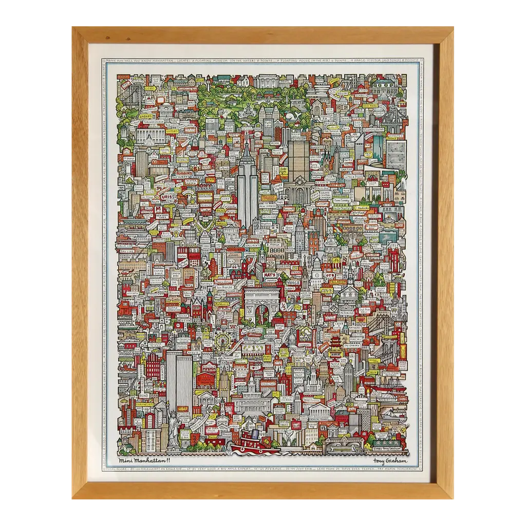
# Tony Graham's "Manhattan!!" Illustrated Map This remarkable piece before you is Tony Graham's iconic illustrated map titled "Manhattan!!" - a stunning visual representation of New York City's most famous borough rendered with exceptional artistic detail and cartographic charm. ## Historical Background Tony Graham's illustrated maps became highly sought-after collectors' items beginning in the late 1970s and early 1980s. This particular illustrated map of Manhattan appears to be from his celebrated city series that gained popularity during this period. Graham's distinctive style combined architectural precision with whimsical illustrated elements, creating pieces that functioned both as navigational references and as decorative art. During this era, illustrated cartography experienced a renaissance, with artists like Graham reviving the centuries-old tradition of pictorial mapping that dates back to medieval European cartographers. These modern interpretations captured the energy and character of urban environments in ways conventional maps simply couldn't. ## Materials and Production This piece was produced using high-quality lithographic printing techniques on premium acid-free archival paper. The printing process involved creating separate color plates that were precisely aligned to achieve the vibrant yet controlled color palette characteristic of Graham's work. The fine line work and delicate coloring demonstrate the meticulous craftsmanship involved in creating illustrated maps of this caliber. The border and matting appear to be original to the piece, with the signature "Tony Graham" prominently displayed in the lower right corner, consistent with the artist's authentication practices. The rich blues, reds, and greens used throughout the illustration were achieved through careful color separation and professional lithographic reproduction methods common to fine art prints of this period. ## Date of Creation Based on the architectural elements depicted, particularly the skyline featuring prominent buildings like the Empire State Building but notably missing structures built after the mid-1980s, this map likely dates to approximately 1982-1985. The artistic style and printing techniques are also consistent with this period in Graham's career when his city illustrations were at the height of their popularity. ## Current Market Trends Vintage illustrated maps have experienced a significant resurgence in collector interest over the past decade. Several factors have contributed to this trend: 1. Interior design professionals increasingly incorporate vintage maps as statement pieces in contemporary spaces, particularly in urban apartments and professional offices where they serve as sophisticated conversation pieces. 2. The growing appreciation for analog artisanship in our digital age has elevated illustrated cartography from mere decoration to respected collectible art. 3. City-specific memorabilia, particularly of iconic locations like Manhattan, continues to appeal to both residents and those with personal connections to these locations. 4. The limited availability of original Graham maps has created a robust secondary market, with well-preserved examples commanding premium prices. This particular example represents a superb acquisition opportunity for collectors of vintage cartography, New York memorabilia, or distinctive wall art with historical significance. The piece would be ideally displayed in a UV-protective frame to preserve its remarkable color fidelity and would make an exceptional focal point in a home study, office environment, or sophisticated living space.
Similar products